
Special Montreat Minute 09/26/25
Weather Update for Montreat Residents
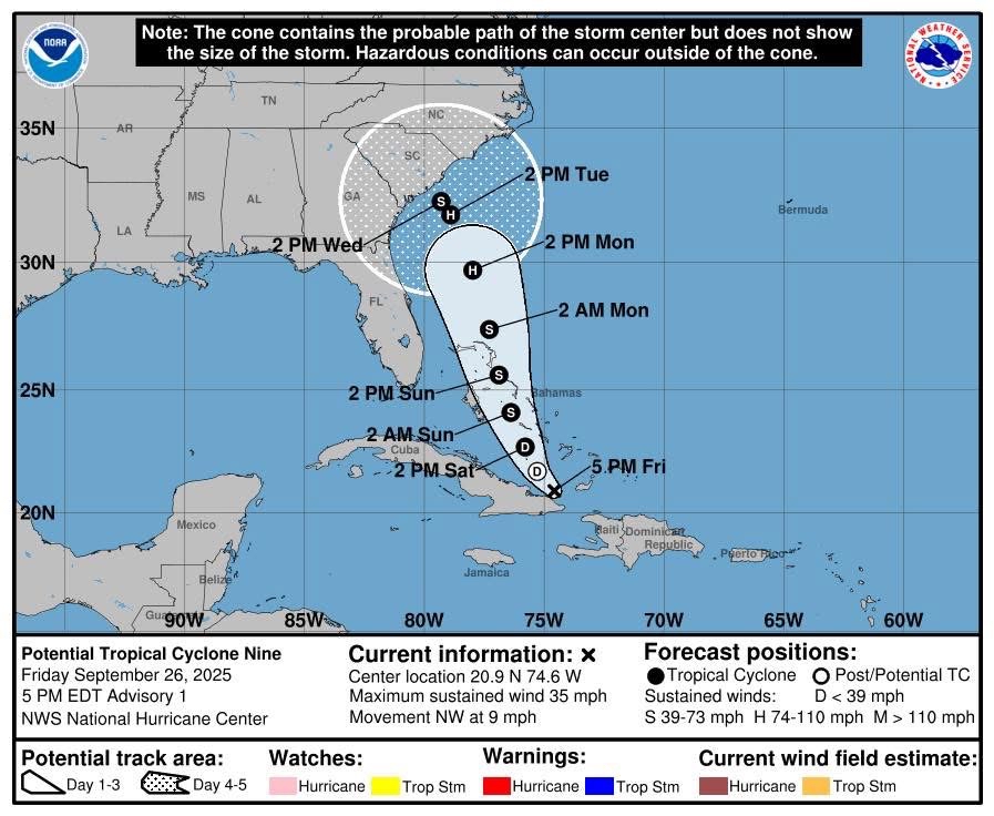
Models continue to indicate that heavy rainfall will be possible across Western North Carolina on Monday and Tuesday as the remnants of future Imelda move through the region. At this time, wind gusts do not appear to be a major concern with this system, but localized flooding remains very possible, especially in areas that are prone to high water during extended rain events.
We understand that the anniversary of Tropical Storm Helene is fresh in many minds, and we know that brings added concern and anxiety. Please know that the Town of Montreat is watching this system closely, coordinating with Buncombe County Emergency Services, and will keep the community updated as new information becomes available.
In the meantime, we encourage residents to take simple preparedness steps:
• Check drainage areas on your property to ensure they are clear of debris.
• Avoid parking vehicles in low-lying areas that are prone to flooding.
• Have flashlights, batteries, and basic supplies such as bottled water in case of power outages.
• Never attempt to drive through flooded roadways. Just a small amount of moving water can carry away a vehicle.

For the most reliable and immediate emergency alerts, please sign up for CodeRED notifications through both the Town of Montreat and Buncombe County. These systems will send you critical information directly to your phone, email, or text message.


